Abstract
"They straightened out the Mississippi River in places, to make room for houses and livable acreage. Occasionally the river floods these places. 'Floods' is the word they use, but in fact it is not flooding; it is remembering. Remembering where it used to be. All water has a perfect memory and is forever trying to get back to where it was. Writers are like that: remembering where we were, what valley we ran through, what the banks were like, the light that was there and the route back to our original place."
— Toni Morrison, The Site of Memory
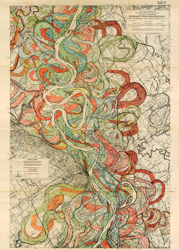
River basins contain geological memories of their previous courses. Over the course of its life, a river meanders, winding back and forth across a basin. We can track these meanders from the landscape today, tracing memory and drawing the past out of the present.
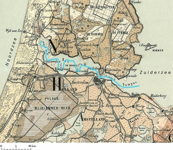
In addition to their "natural" courses, rivers are shaped by human action through dams, canals, and locks. The Amstel is one such river, controlled for centuries by the Dutch to prevent flooding and maximize trade. As a resident of the city, I want to investigate how the topology of the river has changed over time, overlaid on top of the current city map.
In addition, I want to investigate how rivers can be forgotten. I grew up in the Oakland Hills, where a series of creeks and watershed canyons have been paved over and hidden underground; these rivers break out through potholes, recreate their flows during storms, and are slowly being daylighted through several restoration projects. Mapping these rivers connects my present in Amsterdam with memories of my past in California.

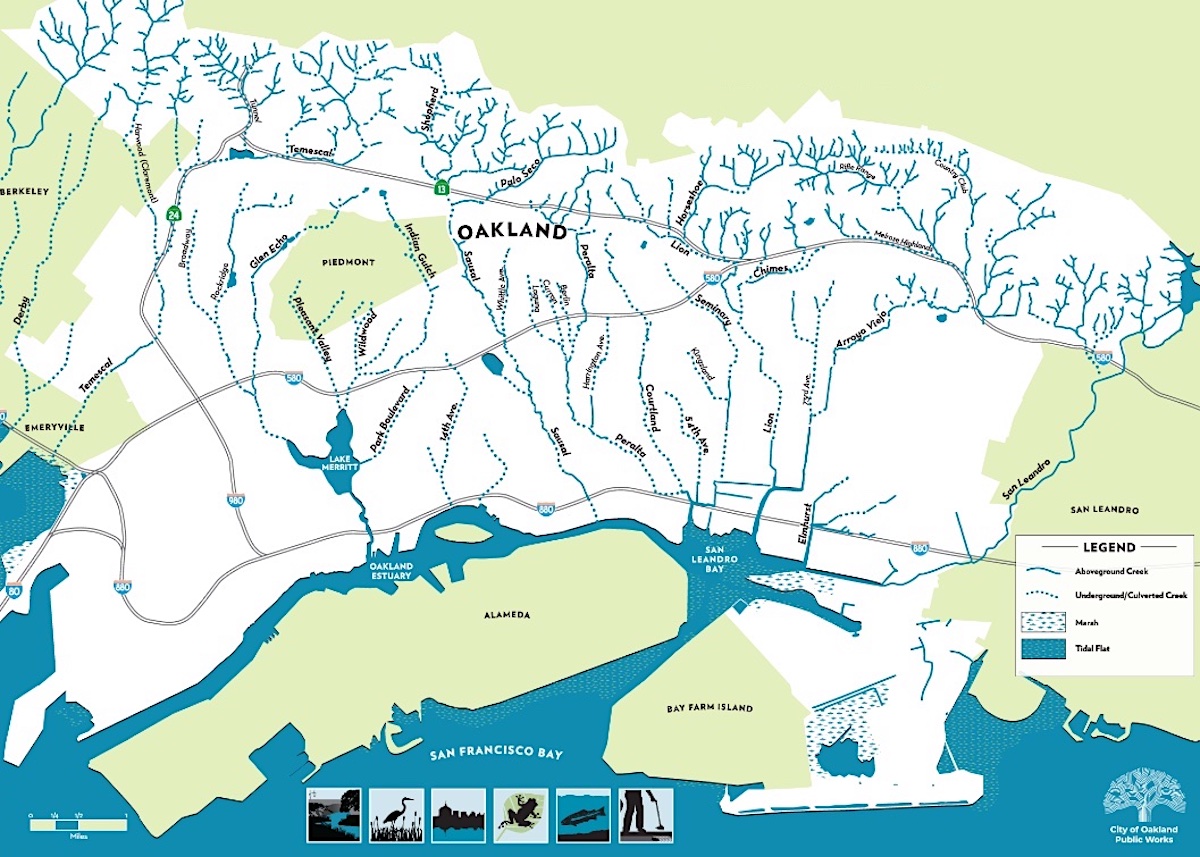
Oakland's buried creek network, slowly being daylighted through urban watershed restoration projects.